Mine-Free Glenaladale Fundraising
Help keep Glenaladale Mine Free
Info about fauna and flora goes here
Our Story
From Rejection to Rescoping: The Ongoing Fight Against the Fingerboards Mine
The Fingerboards Mineral Sands Mine proposal in Glenaladale, East Gippsland, has faced more than two decades of community concern and opposition. After previous exploration companies abandoned the site due to challenges including water availability and mining depth, Gippsland Critical Minerals (formerly Kalbar) revived the proposal. Following an extensive Environment Effects Statement process, the original mine was rejected in 2021 due to significant risks to agriculture, waterways, Ramsar wetlands, threatened species, Cultural Heritage, human health, and the Gippsland Lakes. Despite the project being re-scoped and the company rebranded, the proposed mine continues to threaten East Gippsland’s environment, communities, and future.
The History of the Fingerboards Mineral Sands Mine Proposal
It began in 2002 when Rio Tinto drilled for minerals at the Fingerboards at Glenaladale 25 kilometres from Bairnsdale in East Gippscland, Victoria. Oresome took over the exploration lease in 2011 and undertook a feasibility study. Both companies did not proceed, water availability and depth of mining were factors in abandoning the Fingerboards site. In 2014 a devastating fire swept through the Glenaladale area, burning over 6,000 hectares of farmland, housing, stock and farm infrastructure.
Kalbar Arrived as Communities Faced Their Losses
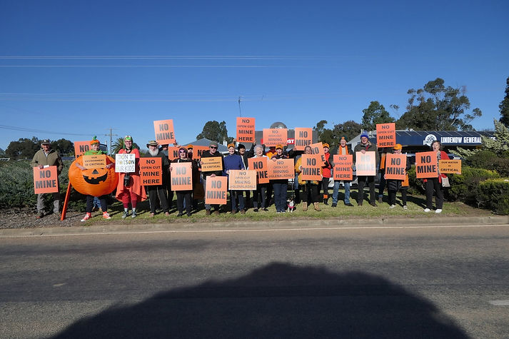
Kalbar, a mining development company, arrived while landowners were coming to terms with their losses. The community rallied establishing Mine Free Glenaladale to oppose Kalbar’s mineral sands mine. The fight against Kalbar lasted 8 years and in 2021 following an extensive EES process the mining proposal was rejected by the former Planning Minister and the Independent Advisory Committee.
Why the Original Proposal Was Rejected
The risks were deemed too great in this location due to the impacts it would have on the multi-million dollar agricultural and horticultural industries, critically endangered species and ecosystems, human health, RAMSAR wetlands and the Gippsland Lakes, Cultural Heritage and surface and ground water. Over 900 submissions were received expressing opposition to the mine (the largest number to oppose a mine in Victoria) and over 100 people presented verbal submissions at the hearings. The community thought that was the end of the mining proposal.
Project Renewed and Company Rebranded
In 2024 the Earth Resources Regulator renewed two Retention Licences and Kalbar was rebranded as Gippsland Critical Minerals (GCM). GCM was given 12 months to re-scope the project, address the findings of the Environment Effects Statement the impacts and threats in the report, improved community consultation and gain support from First Nations Peoples.
The project area now covers over 6,000 hectares with the mine footprint in excess of 2,000 hectares. The maximum depth of the mine will be 58 metres and will cover a disturbed area at any one time of 200 hectares.
It is situated on a plateau the watershed of the Heritage Mitchell River and the Perry River (chain of ponds) which flow into the RAMSAR listed Gippsland Lakes and wetlands.
In the original Kalbar project 570 hectares of Cultural Heritage were identified in the project area. The figure could be much larger as infrastructure areas outside the mine footprint have not been surveyed. This is an important Cultural area for Gunai Kurnai peoples.
The Victorian Government have announced that another Environment Effects Statement is required for the re-scoped project and under the EPBC Act 1999 GCM must address four controlled actions. These include RAMSAR wetlands (Gippsland Lakes), threatened species, migratory species and nuclear action (thorium, uranium and monazite are present in the ore body).
The Ongoing Toll on a Community Still Opposed
The wider community of East Gippsland, Gunaikurnai Land and Waters Aboriginal Corporation and local Aboriginal Elders within the community continue to oppose this proposed mining development in this inappropriate location. Twelve and a half years of opposition to this proposal have taken a huge financial and human toll on community members.
The Current Fingerboards Proposal Still Fails to Address Key Concerns
Gippsland Critical Minerals/Kalbar’s initial design changes to the rescoped project will do little to address the multiple impacts and threats identified following the extensive Environment Effects Statement (EES) process and rejection of the initial project proposal in 2021.
Proposed changes:
-
1.5 kilomentre buffer from Lindenow Valley horticulture area. This will not stop the dust contaminating crops
-
Slowing the mining rate and extending the timeline from 15 to 22 years to reduce resident’s exposure to dust, noise and truck traffic (an extra 7 years exposure). Dust, noise, light pollution and truck movements will affect the community 24/7 365 days a year
-
In pit tailings disposal will cause leaching of radioactive substances and chemicals into soil, ground water, the Mitchell and Perry Rivers and the Gippsland Lakes
-
Fencing and revegetation of three main gullies will give little protection as the catchments will be mined and there is no protection for the extensive gully systems that exist in the proposed mining area
-
Heavy mineral concentrate from the separation process is to be stored in a shed before being transported off site. This will not protect workers or the community from exposure to radioactive thorium, monazite and uranium
-
The planned Bairnsdale/Dargo Road diversion and construction of the processing plant on privately owned land will mean the landholder will never farm the property again
-
Clearing of 1.7 kilometres of the Bairnsdale/Dargo Road will see the destruction of threatened red gum grassland species
-
15% of the mine area will be disturbed at any one time, this equates to over 200 hectares, dust and mine water runoff will be impossible to contain in such a large area
-
Gippsland Critical Minerals claim it is a smaller mining area than the previous project. The proposed mining licence area is 2,040 hectares, 1,900 hectares of this will be mined, this is larger than the original Kalbar proposal which was 1,675 hectares with 1,350 to be disturbed
-
Construction of a 2 gigalitre “community benefit” dam for the horticulture industry, this will contain mine runoff water and not be suitable for food production due to contaminants - legally and logistically inappropriate
-
Construction of a railsiding between Lindenow South and Fernbank to transport Heavy Mineral Concentrate for the final processing, will impact critically threatened species and disrupting the catchment of Saplings Morass and Lucas Creek, a tributary of the Mitchell River
-
Prioritising on shore processing of Heavy Mineral Concentrate in the Northern Territory or Western Australia, at this point processing plants have not been built in Australia
-
The mining regulations are such that Work Plan variations can occur once a mining proposal has been given the green light. The community has no right to address these changes.
-
This will be the largest vegetation clearance in Victoria of any recent development despite the changes GCM have made to the project
The Test Pit: An Inadequate Demonstration with Environmental and Regulatory Concerns
A test pit has been constructed between two major gullies which flow into the Mitchell River. This mini-mine has not been subject to Environment Protection and Biodiversity Conservation Act scrutiny despite Heavy Mineral Concentrate to be mined which should trigger nuclear action and any runoff could threaten the Ramsar listed wetlands and Gippsland Lakes, critically endangered species and Ecological Vegetation Classes could be destroyed.
According to Gippsland Critical Minerals the test pit was to provide evidence under real conditions how the Fingerboards project can be mined and restored “Designed to replicate methods and provide robust scientifically validated data” and "...provide the community and regulators a clear representative preview of the new project in operation”. No base line studies have been available.
The test pit covers a disturbed area of 4 hectares with the pit being .6 of a hectare in size and 22 metres deep. Whereas the proposed mine will have a maximum depth of 58 metres, have a disturbed area of in excess of 200 hectares. The test pit will not replicate the final mining operation
Last updated July 2026